RFG Napló
A magyarországi térinformatikai közösség tagjai számára vagy részéről közérdeklődést feltételező hírek, felhívások. Part of this blog (April 2006 - June 2015) is historical material, "frozen in time." The blog posts dated prior June 1 2015 will no longer changed. Some links to external web sites and internal pages will not work.
2024-04-03
VISSZATEKINTÉS: Figyelemfelhívás az OMFB elnökhelyettese számára Clinton elnök Nemzeti Téradat Infrastruktra rendeletéről
2024-03-13
VISSZATEKINTÉS 1990 októbere Az USDA-FM/FÖMI tudományos együttműködés tanulmányúti programja (Földmegfigyelés, térinformatika, éghajlatváltozás, intézményközi együttműködés)
Jelenlegi trendek és kutatási irányzatok - 'Digital Twins' technológia a fenntartható fejlődési célok monitoringjában. Cikkeket várnak Big Earth Data szakfolyóirat különszámába.
2024-03-11
Újabb ISDE tematikus előadások a nagytömegő adatok elemzése, modellmegosztások a Digitális Föld kontextusában március 27-én. Jelentkezés az ISDE Titkárságon keresztül
2024-03-06
Letölthető a CEOS és ESA földmegfigyelési kézikönyve (2023-as e-kiadás)
Elérhetősé: https://eohandbook.com/gst/
A CEOS-ESA anyag illusztrációja a földmegfigyelési adatok szerepét és jelentőségét közérthetően hangsúlyozza a Párizsi Klimaegyezmény kontextusában.
2024-03-05
Dr Szabó Szilárd, az egykori Térinformatika szaklap főszerkesztő interjúja Dr Remetey-Fülöpp Gáborral (2023)
A 2023 végén készített interjú Remetey-Fülöpp Gábor életútjának, szakmai pályafutásának egyes fontos részletét mutatja be. A beszélgetés során szó esik a családjáról, felmenőiről, valamint arról, hogy hogyan választotta a földmérőmérnök és geodéziai automatizálás szakmérnöki pályát.
A kérdésekre adott válaszok betekintést engednek Remetey-Fülöpp Gábor térinformatikai, távérzékelési tevékenységébe, nemzetközi szakmai kapcsolataiba és meglátásaiba.
Az interjú Szabó Szilárd – Kummert Ágnes: A térinformatika személyiségei c. interjúkötetben jelent meg az NJSZT iTF jóvoltából 2024-ben. Linkje: https://itf.njszt.hu/wp-content/uploads/2024/02/a_terinformatika_szemelyisegei.pdf (137-149 oldalak)
További kiadványok jelentek meg Havass Miklós gondozásában az NJSZT iTF Térinformatika-történeti Füzetek 2024-ben indult sorozatában, köztük
Havass Miklós – Remetey-Fülöpp Gábor – Szabó Szilárd: A térinformatika alkalmazásainak áttekintő története Magyarországon és
Dr. Mihály Szabolcs – dr. tech Niklasz László: A térinformatika kezdetei Magyarországon
2024-02-28
2024-02-20
Posztdoktori lehetőség a Heidelbergi Térinformatikai Technológiák Intézetében klímavédelmi cselekvések témakörében
International Postdoctoral Fellowships for GIScience Research for Climate Action
Dear Postdoctoral Scholars and Researchers,
You are a highly motivated researcher who loves spatial data science and open geodata? You want to use your expertise for the benefit of society and the environment – in particular stimulating Climate Action or enhancing Humanitarian Aid related to Climate Resilience? You want to improve the availability and quality of open geographic information for Climate Mitigation and Adaptation and develop high resolution spatial indicators or GIScience methods for open, non-profit applications in those areas? Then we actually might have a suitable and interesting opportunity for you!
HeiGIT gGmbH (Heidelberg Institute for Geoinformation Technology) at Heidelberg University is pleased to announce a call for applications for a Postdoctoral Fellowship (6 – 12 months) focused on GIScience research, with a special emphasis on work related to upscaling actionable geoinformation for climate mitigation and adaptation. This fellowship provides an exciting opportunity for scholars to contribute to cutting-edge research and innovation in the field of geoinformatics, with a particular focus on leveraging and enhancing open geodata, especially Volunteered Geographic Information (VGI) and Remote Sensing for climate action orhumanitarian aid.
About HeiGIT: HeiGIT gGmbH, is a leading applied non-profit research institute dedicated to advancing the field of geoinformatics. The objective of HeiGIT is to improve knowledge and technology transfer from fundamental research in geoinformatics to practical applications. Our vision is a better society and environment by improving open geoinformation and geoinformation technology. Our mission is to provide research and development to support decision making in the field of climate action, sustainable mobility and humanitarian aid. We accomplish this through open geoinformation, open methods, open software and close collaboration with our partners. Our work encompasses a wide range of applications, from developing innovative tools and methodologies to address societal challenges to promoting open geospatial data for the greater good.
Részletek: https://heigit.org/join-the-team/
Forrás: AGILE körlevél. Közreadó:
2024-02-19
A térinformatika magyarországi történetét áttekintő tanulmányok készültek az NJSZT iTF műhelyében!
Havass Miklós ma reggeli tájékoztatásának köszönhetően osztom meg az alábbi friss hírt az NJSZT Informatikatörténeti Fórum honlapjáról:
A térinformatika magyarországi történetét áttekintő tanulmányok készültek az NJSZT iTF műhelyében!
Elérhető a fenti linkre kattintva.
Okosítás a digitális és virtuális térben - YSIN webinár február 28-án
Az ISDE Titkárságáról érkezett körlevél, amely közérdeklődésre tarthat számot:
"You are cordially invited to participate in the 1st ISDE-YSIN Quarterly Webinar Talk, with the theme of "Smartification in the Digital and Virtual Space". The ISDE-YSIN Quarterly Webinar Talk will be organized quarterly each year, aiming to invite the world-leading scientists and rising young scientists to share their cutting-edge research outcomes and enhance the connection and research collaboration among YSIN members and beyond. The 1st webinar talk information is as below:
Host: International Society for Digital Earth (ISDE)
Organizer: International Society for Digital Earth - Young Scientist Innovation Network (ISDE-YSIN)
Time: Wednesday, February 28, 2024, 16:00-17:30 (Beijing Time)
Speaker 1: Stefano Nativi (Council of National Research, Italy)
Talk Topic: Digital Transformation and the Smartification Process
Speaker 2: Xintao Liu (The Hong Kong Polytechnic University, China)
Talk Topic: Exploring Human Activity Patterns in a Hybrid Physical-Virtual Space
For more information about the 1st ISDE-YSIN Quarterly Webinar Talk, please visit:
http://www.digitalearth-isde.
If you want to give lectures here in the future, please contact the ISDE Secretariat at isde@radi.ac.cn.
Best regards,
Secretariat of International Society for Digital Earth
No.9 Dengzhuang South Road, Haidian District, Beijing 100094, China"
ISDE Website: www.digitalearth-
LinkedIn @International Society for Digital Earth
Facebook @International Society for Digital Earth
Twitter @ISDEsecretariat
YouTube @isde_digitalearth
The trend of Smartification refers to the process of retrofitting or producing previously disconnected analog assets with sensor and wireless technologies, making them 'smart' and connected, bridging the analog-digital divide.
2024-02-01
Megjelent a 'Térinformatika személyiségei' címmel Dr. Szabó Szilárd és Dr. Kummert Ágnes interjúkötete
Havass Miklós, a Magyar Térinformatikai Társaság (HUNAGI) első elnöke, a Neumann János Számítógéptudományi Társaság iTF Térinformatika-történeti Füzetek megvalósítója értesítése szerint Dr.Szabó Szilárd, az egykori Térinformatika szaklap főszerkesztője jóvoltából megjelent a sorozat egy interjúkötete, amely a szaklap 2002-2005 közötti időszakából válogat. Az e-kiadvány linkje
Térképészet és térinformatika a Digitális Föld Nemzetközi Társaság (ISDE) legfrissebb hírében
The ICCGIS is a biannual conference that started in 2006 and since then it welcomes scientists from all over the world to its very successful and fruitful events in 2006, 2008, 2010, 2012, 2014, 2016, 2018 and 2022. For those 18 years of experience, the Conference had attendees from more than 60 countries and has published more than 700 scientific papers in its proceedings.
The 9ICCGIS is organized by:
- International Cartographic Association
- Bulgarian Cartographic Association
- University of Architecture, Civil Engineering and Geodesy
- 11 February - abstract submission
- 18 March - acceptance of abstracts
- 31 March - early registration
- 1 May - full paper submission and registration of authors
Contact Information
Website: https://iccgis2024.
Email: iccgis.bulgaria@gmail.com
Best regards,
Secretariat of International Society for Digital Earth
No.9 Dengzhuang South Road, Haidian District, Beijing 100094, China
ISDE Website: www.digitalearth-isde.org
LinkedIn @International Society for Digital Earth
Facebook @International Society for Digital Earth
Twitter @ISDEsecretariat
YouTube @isde_digitalearth "
--
To view this discussion on the web, visit https://groups.google.com/d/
2024-01-26
Megjelent „A térinformatika alkalmazásainak áttekintő története Magyarországon” tanulmány az NJSZT Informatikatörténeti Fórum honlapján
Havass Miklós „A térinformatika alkalmazásainak áttekintő története Magyarországon” című tanulmány egyik szerzője tegnap arról értesítette szerzőtársait és a hozzájárulásaikkal közreműködőket, hogy a 210 oldalas anyag az NJSZT Informatikatörténeti Fórum (iTF) munkatársainak jóvoltából felkerült az iTF honlapjára és itt érhető el. A tájékoztatás szerint az MTA Könyvtár és Információs Központ jóvoltával jelenleg folyik a Térinformatika szaklap digitalizálása. Miután a szóbanforgó tanulmány sok hivatkozást tartalmaz a lapra, a szerzők azt tervezik, hogy a digitalizálás megtörténte után linkeket helyeznek el a tanulmány újabb verziójában. Ez módot ad arra, hogy egyben a kirívó tévedéseket is javítsák.
A szerzők, Havass Miklós, Remetey-Fülöpp Gábor és Szabó Szilárd információ gyűjtő munkája eredményeként összegyűlő tanulmányokból Havass Miklós vezetésével külön „iTF Térinformatika-történeti Füzetek” c. sorozatot szerveztek, amelyet a továbbiakban is bővíteni szeretnének a térinformatikával kapcsolatban készült fontosabb tanulmányokkal, munkaanyagokkal, amelyek eddig nem kerültek digitálisan kereshető publikálásra. A sorozat mindenkori állapota úgy található meg, ha az iTF honlap jobb felső sarkában található „Keresés a honlapon” ablakba pl. az kerül begépelésre, hogy „Térinformatika-történeti”
A sorozat máris számos értékes kéziratot, riportot, publikációt tartalmaz. Egy mai keresés eredménye (képernyőkép részlet az iTF honlapjáról):
2024-01-24
Térinformatika, távérzékelés és mesterséges intelligencia a katasztrófavédelemben
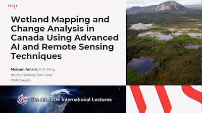
'Távérzékelés és térinformatika a természeti veszélyhelyzet-kezelésben és a katasztrófa-elhárításban' volt a témája az ISDE mai, 8. nemzetközi előadás sorozatának. A tervezett három helyett két előadás és vitája hangzott el 110+ meghívott résztvevővel, köztük Wang Changlin és Milan Konecny professzorokkal. Mindkét előadás témaköre aktuális:
- egy iráni kiszáradó tó vizgyűjtőjének a globális változás okozta környezeti hatások vizsgálata integrált térinformatikai módszertannal támogatott tér-idő monitoringgal,
- vizes területek tematikus térképezése és változás-elemzése fejlett mesterséges intelligencia (MI) és távérzékelési technikákkal.
A Clark Egyetem szakértője részéről spontán együttműködési ajánlat hangzott el a kanadai előadó felé. A Digitális Föld Nemzetközi Társaság (ISDE) előadás-sorozatához a szervezet titkárságán keresztül lehet csatlakozni. Az elérhetőségek:
Secretariat of International Society for Digital Earth
No.9 Dengzhuang South Road, Haidian District, Beijing 100094, China
For more information about the 8th ISDE International Lectures, please visit:
http://www.digitalearth-isde.
If you want to give lectures here in the future, please visit:
http://www.digitalearth-isde.
ISDE Website: www.digitalearth-
LinkedIn @International Society for Digital Earth
Facebook @International Society for Digital Earth
Twitter @ISDEsecretariat
YouTube @isde_digitalearth
2024-01-19
A HUNAGI fénykorából: SDI/INSPIRE témakörhöz kapcsolódó tevékenységek 2010 (előadásanyag)
Publikáció a HUNAGI fénykorából...
A Délkelet-európai régió országai számára Prof.Bashkim Idrizi és Dimo Todorovski szervezésében, a Geo-SEE, FIG, ITC, EUROGI, a FON és Tetova Egyetemek, valamint a Macedón Bejegyzett Földmérők Kamarája támogatásával inagyszabású konferenciát rendeztek 'Téradat Infrastruktúrák 2010' címmel Skopjéban. A konferencia magyar előadásanyaga nemzetközileg bírált cikk formájában a 63-75 oldalakon található. Ez a legátfogóbb áttekintése a HUNAGI akkori tevékenységének, amely angol nyelven megjelent. A szerzőtől megkérhető maga a vetített-képes változat is.
A rendezvény nemzetközi szervező bizottság tagjai voltak Osskó András FIG VII Bizottság elnöke, és Zentai László professzor ICA főtitkár mellett .Alessandro Annoni (SDI Unit, JRC), továbbá a FIG (Stig Enemark), ICA (Fraser Taylor, Georg Gartner, Milan Konecny), EUROGI, (Mauro Salvemini), OGC (Mark Reichardt) és GSDI (Ian Masser) vezető tisztségviselői. akik az előadásanyagok bírálói között is szerepeltek.2024-01-12
ISDE előadások katasztrófavédelem témakörben (mesterséges intelligencia, távérzékelés, térinformatika)
2023-11-07
1996-2000: a magyar vezetésű ISPRS VII Bizottság képes szakmai beszámolója elérhető az NJSZT Informatikatörténeti Fórumán
Havass Miklós (a MTESZ és HUNAGI volt elnöke) közbenjárásával az anyag felkerült az NJSZT ITF honlapjára. A Link:
A tárgykör informatikatörténeti relevanciáját adja, hogy az ISPRS szervezet tudományos viziója röviden: "Information from imagery". Bővebben egy cikk vezető ISPRS tisztségviselők tollából: https://www.sciencedirect.com/science/article/abs/pii/S092427161500218X Megjelent azISPRS Journal of Photogrammetry and Remote Sensing szaklapban (Volume 115, May 2016, Pages 3-21).A tisztségre jelölést az MFTTT elnöke, Detrekői Ákos akadémikus tette meg az ISPRS felé annak 1996.évi bécsi kongreszusa előtt. A nagymúltú, 1910-ben Bécsben alapított ISPRS szervezetnek Magyar Nemzeti Bizottsága is van, melynek munkájához a jelölés idején főleg a FÖMI, a BME, Eurosense Kft szakemberei járultak hozzá.
2023-09-28
Integrált térinformatikai keretmunka (IGIF) a fenntartható fejlődésért és a társadalmi jólétért
Sűrített beszámoló rövidesen itt!
 |
| Credit: UN-GGIM E Webinar, 2023. szeptember 27 |
Terv szerint hamarosan itt következik a keretmunka lényegi összefoglalása, a webináron bemutatott egyesült-királyságbeli, német és georgiai esettanulmány, továbbá a közeli ENSZ Európai Gazdasági Bizottság-EUROSTAT-UN GGIM-E konferenciát beharangozó előadás rövid ismertetése.
Az IGIF egyike a UN GGIM öt szakmai irányának. Továbbiak a következők:
Globális geodéziai vonatkozási keretek,
Adatintegráció,
Fenntartható fejlődési célok (Megj.: az ebben végzett tevékenység különösen érdekes lehet az MFTTT WG4SDG számára!),
Adatstratégia és -politika.
2023-09-16
Figyelemreméltó japán kiadvány az ENSZ "Fenntartható Fejlődési Célok Csúcstalálkozón"
A Fenntartható Fejlődési Célok elérése ügyéért érdeklődők számára!
"Dear EO4SDG colleagues,
JAXA was asked to publish the SDGs efforts in the Better World Vol9 (first article!).
The book will be distributed (on sale) at the 2023 SDGs Summit in the UN HQ.
https://www.un.org/en/
Thank you
Osamu Ochiai"
Megj.: a dokumentum részletet az MFTTT WG4SDG munkacsoportja is tanulmányozza. Egyébként a hazai munkacsoport tevékenységéről a genfi GEO titkárság, valamint a CEOS Információs Rendszerek és Szolgáltatások munkacsoportjának washingtoni vezetése egy hónapja kapott részletes angolnyelvű leírást Dr. Mihály Szabolcs és szerzőtársai összeállításában


